
 Harriet Wetton
Buying land, building a home, or putting up a privacy fence should feel exciting. Yet, for many property owners, the process brings unexpected stress.
You might find yourself arguing with a neighbor over where a driveway ends, or staring at legal documents filled with land terms that sound like a foreign language.
If you feel confused or worried about making an expensive land mistake, you are not alone. Property lines are invisible, but getting them wrong has real costs.
A plat of survey is the single most important map you can own as a property owner. It shows exact property lines, structures, measurements, and legal boundaries.
This guide walks you through everything you need to know about survey plats in simple terms, so you can protect your investment and make smart real estate decisions with total confidence.
What Is a Plat of Survey?
What Is a Plat of Survey in Simple Terms?
A plat of survey is an official drawn-to-scale map of a piece of land. It is created by a licensed professional land surveyor who physically measures the property and researches historical records.
Think of it as a detailed blueprint for your land boundaries. It shows the exact shape of your lot, the length of each boundary line, and where structures sit relative to those lines.
Why Does a Survey Plat Matter So Much?
Without a plat of survey, you are essentially guessing where your property starts and stops. Fences, trees, and grass lines are not legal markers.
A plat of survey matters because it:
-
Establishes legal land boundaries recognized by courts and banks.
-
Prevents boundary disputes with neighbors before they start.
-
Reveals hidden easements, rights-of-way, and setback limits.
-
Protects you when buying, building, or selling real estate.
If you are planning to purchase land for a new project, knowing how to evaluate the site geometry and location details is essential. You can learn more about assessing land features in our guide on how to choose a construction site location.
Key Elements Found on a Plat of Survey
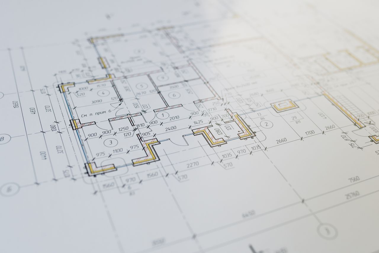
When you look at a plat of survey, you will see several standard components:
-
Property Boundaries and Bearings: Lines with distances and angles showing exact lot boundaries.
-
Monuments and Pins: Physical markers set in the ground, like iron pipes or concrete monuments.
-
Existing Structures: Houses, garages, sheds, decks, and driveways drawn to scale.
-
Easements: Rights granted to utility companies or neighbors to cross or use portions of your land.
-
Setback Lines: Local zoning rules showing how far structures must sit from property lines.
-
North Arrow and Scale: Standard map controls to show orientation and size ratios.
-
Surveyor Stamp and Certification: The official seal and signature of the licensed surveyor.
How a Plat of Survey Works Step-by-Step
Creating a plat of survey involves both field research and physical measurement:
| Step | Process | What Happens |
| 1 | Historical Research | The surveyor checks public deeds, old records, and city plans for past land details. |
| 2 | Field Survey & Measurements | The team measures the land in person using tools to find physical markers and pins. |
| 3 | Drafting the Plat | The field numbers are turned into an accurate, drawn-to-scale land blueprint. |
| 4 | Official Stamp & Recording | The licensed surveyor seals the document and files it with local government records. |
Step 1: Researching Public Records
The surveyor starts in local county records offices. They pull historic deeds, recorded subdivision plats, utility agreements, and surrounding property records to build a historical map of your parcel.
Step 2: On-Site Field Measurements
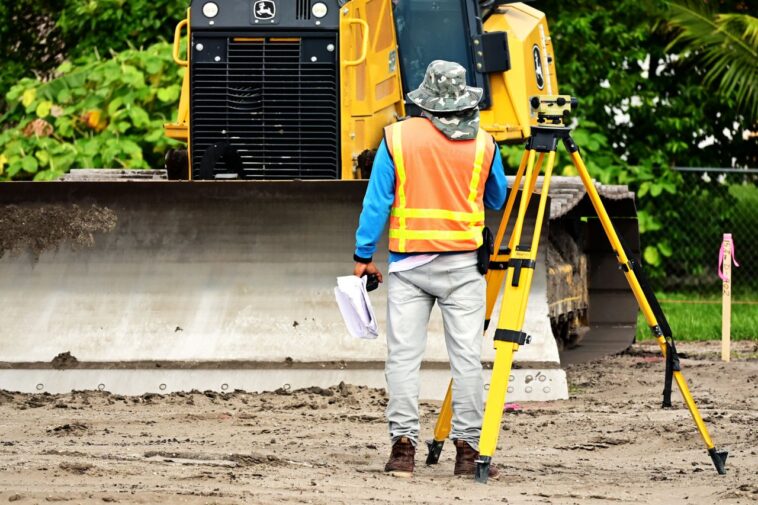
Using specialized equipment like GPS units and robotic total stations, the surveyor measures the property in person. They look for existing boundary markers (iron pins, pipe caps, or stone markers buried underground).
Step 3: Calculating and Drafting
Back at the office, the surveyor compares field data with official public records. Any discrepancies are calculated and resolved according to surveying principles. The final drawing is created on CAD software.
Step 4: Stamping and Certification
The surveyor signs and seals the document with their official state license stamp. This seal turns the drawing into an official legal document.
Real-Life Example: Saving a $15,000 Mistake
Imagine Noah and Nora, who bought a suburban home featuring a large backyard. They decided to install a $15,000 custom wooden privacy fence along what they assumed was their yard edge based on where the previous owner mowed.
Before digging, their fencing contractor asked for a plat of survey. Noah ordered a fresh survey. The surveyor discovered that the existing tree line was actually 6 feet inside the neighbor’s lot, while a hidden utility easement ran along the eastern boundary.
If Noah had built the fence based on visual assumptions, he would have encroached on his neighbor’s land and blocked utility access.
He would have been forced to tear down the brand-new fence at his own expense. Spending a few hundred dollars on a survey plat saved Noah thousands of dollars and preserved his relationship with his neighbor.
Smart buyers always verify property details before closing a transaction. If you want to protect your savings while navigating real estate purchases, read our guide on how to recognize real estate scams.
Common Mistakes to Avoid with Property Surveys
-
Relying on Old Surveys: Boundaries do not change often, but additions, fence installations, and local zoning laws do. An outdated plat might miss new structures or easements.
-
Assuming Fences Mark the Property Line: Neighbors often put fences in convenience spots rather than along precise legal boundaries. Never treat a fence line as a boundary line.
-
Skipping a Survey When Buying Cash: Lenders require surveys, but cash buyers sometimes skip them to save money. This leaves you vulnerable to hidden encroachments.
-
Ignoring Easement Details: Reading the map without checking text notes can lead to building structures over underground power or sewer lines.
Types of Property Surveys Explained
Not all land surveys are identical. Depending on your needs, you may encounter different types:
| Survey Type | Purpose | Main Feature |
| Boundary Survey | Locate property corners and lines | Maps lot lines and physical pins |
| ALTA/NSPS Survey | Comprehensive commercial real estate review | Meets national title insurance standards |
| Topographic Survey | Shows land elevation and contours | Used for engineering and drainage planning |
| Subdivision Plat | Splitting one large parcel into smaller lots | Creates new public lot blocks and roads |
| As-Built Survey | Verifies improvements after construction | Shows final positions of completed structures |
Advanced Strategies for Property Owners
Resolving Boundary Encroachments
If your plat of survey shows a neighbor’s structure (like a shed or driveway) crosses onto your land, act calmly and professionally:
-
Obtain an updated boundary survey stamped by a licensed surveyor.
-
Share the official plat with your neighbor to review facts together.
-
Consult a real estate attorney to draft a boundary line agreement or revocable license if needed.
Planning Property Improvements
Always provide your plat of survey to your architect, land planner, or contractor before finalizing project blueprints. This prevents costly permits delays caused by setback violations.
When buying or selling property, experienced professionals can help guide you through local requirements and land documentation.
You can learn more about working with property experts in our detailed breakdown of real estate agents.
For official technical specifications regarding land surveying standards and boundary requirements across the United States, you can refer to the National Society of Professional Surveyors.
Cluster Topics Overview
Understanding a plat of survey naturally connects to several broader property management and real estate subtopics. As you explore land ownership, keep these key themes in mind:
-
Understanding land survey cost factors help you budget effectively for property purchases.
-
Learning how to read a land survey deed map ensures you understand boundaries and angles.
-
Knowing property line dispute solutions gives you a roadmap when disagreements happen.
-
Exploring boundary line agreement steps helps settle minor encroachments amicably.
-
Reviewing easement types on property maps keeps you clear of restricted utility areas.
When to Seek Professional Guidance
You should hire a licensed professional land surveyor whenever you:
-
Purchase a new home or parcel of land.
-
Build major improvements (garages, pools, additions, fences).
-
Subdivide land into smaller plots.
-
Experience a boundary dispute with an adjacent owner.
Always verify that your surveyor holds an active license in your state or jurisdiction.
Frequently Asked Questions
What is the difference between a plot plan and a plat of survey?
A plot plan is a simple, uncertified sketch showing planned improvements. A plat of survey is a legally binding map created, signed, and stamped by a licensed land surveyor.
How much does a plat of survey cost?
Costs vary based on property size, terrain, and location complexity. Standard residential surveys typically range between $400 and $1,200.
How long is a plat of survey valid?
A survey plat does not formally expire, but lenders and title companies usually require one completed within the last 6 to 12 months, or updated since major construction.
Where can I find an existing plat of survey for my home?
You can check with your county recorder of deeds, local zoning department, title company, or the mortgage lender from your purchase closing.
Can I draw my own plat of survey?
No. While you can draw a personal sketch of your yard, only a state-licensed land surveyor can create an official legal plat of survey recognized by courts and government agencies.